Our partner Donegal County Council has co-produced different pre-planning spatial services with their communities in Donegal (Ireland). These services include:
- Citizen Sourced Zoning
- Collaborative Development Planning
- Social Media Sharing Tools
- Online GIS Mapping
This range of services allow local communities to come together to digitise issues relating to their community which they feel should be considered in planning decisions. Issues could differ from defining local road danger zones to determining where a community would like to see various zonings. The platform will allow users to vote on designations so that planners will be able to see which are of most concern/agreement within the community. This local information will feed into the planning decision process and ultimately the county development plan process. Ultimately the users of the system will be all 160,000 citizens of the county.
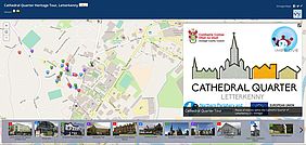
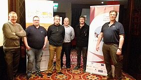
The services have been piloted in a small scale by a local community in Letterkenny led by 6 local champions who are looking at the local issues and how they would like to shape the development of the “Cathedral Quarter” in Letterkenny Town. This is a micro scale project within the County context, but which is bringing very positive results since it’s not only establishing new ways of involving the community in the planning process but also serving to feed and develop additional services by capturing local data to generate Mapstories around relevant themes. For example, the data mapped in the Letterkenny Cathedral Quarter, which was captured to highlight the local historical & cultural locations and was quickly turned into a walking tour map now used by the Community Group as a tourism marketing app. You can access here the Cathedral Quarter Walking Map or by clicking the picture.


